Place-Based Territorial Intelligence
Network for Low Density Regions

A place-based approach to regional development is a key concept of the regional innovation policy in the European Union (EU). This approach entails creating long-term strategies aimed at tackling the economic potentials of specific territories embedded in multilevel governance structures and based on trust among involved actors. In heterogeneous regions, development policy and actions could work effectively when they are based on place specificities. The place-based approach is especially vital to the development context of rural and other low-density population regions, as it aims to strengthen the resilience of depopulated and lagging (shrinking) regions as well as increase the economic competitiveness of these areas, enabling the valorization of the local resources of the territory including the natural, social or human capital. The place-based approach has two pillars: (1) geographical context encompassing social, cultural, and institutional characteristics of the place and (2) knowledge for local development co-created through a participatory process involving all relevant internal and external stakeholders.

Territorial Intelligence comprises specific intelligence spread over the territory, which creates knowledge as a conscious act of design, collection, analysis, and mutualization of available information. Girardot et al. (2007) identify the following five pillars for territorial intelligence: (1) knowledge integration from different disciplines; (2) dynamic vision of territories; (3) involvement of all stakeholders of the territory; (4) collaboration, knowledge co-creation, and exchange; (5) participatory territorial governance. Territorial intelligence is a collective process that involves the participation of multiple agents, integrates external sources of information with territorial agents, and focuses on collaboration to promote sustainable development.

The delimitation of the concept of low-density regions (LDR) is becoming a prominent research subject among the European regional scientists levered by its increasing policy relevance, namely in the Southern and Eastern European regions facing demographic and socioeconomic shrinkage. However, differently from the concept of sparsely populated areas applicable to many Northern European regions, there isn´t a consolidated concept of LDR. It comprises heterogeneous realities, including different rural areas and small and medium-sized cities outside of metropolitan areas, demanding more than one criterion for its delimitation.  The OECD and other institutions (e.g., EUROSTAT) use population density as a chief criterion to distinguish rural areas from urban and metropolitan regions. Worldwide, low population density areas tend to be associated with rural areas.

Who we are?
A multi-actor network connecting society, science and policy actors focused on developing and mapping a geography of opportunities for low-density (LOWD) regions in Portugal.

The network is led by Science (R&I units) that through an ongoing dynamic process engage society and policy actors in collective intelligence co-creation platforms based on and targeting pilot LOWD territories.

Our mission
To empower citizens, businesses, researchers, and institutions with contextualized, usable and accessible data, knowledge, and tools facilitating informed decision-making at the local level.

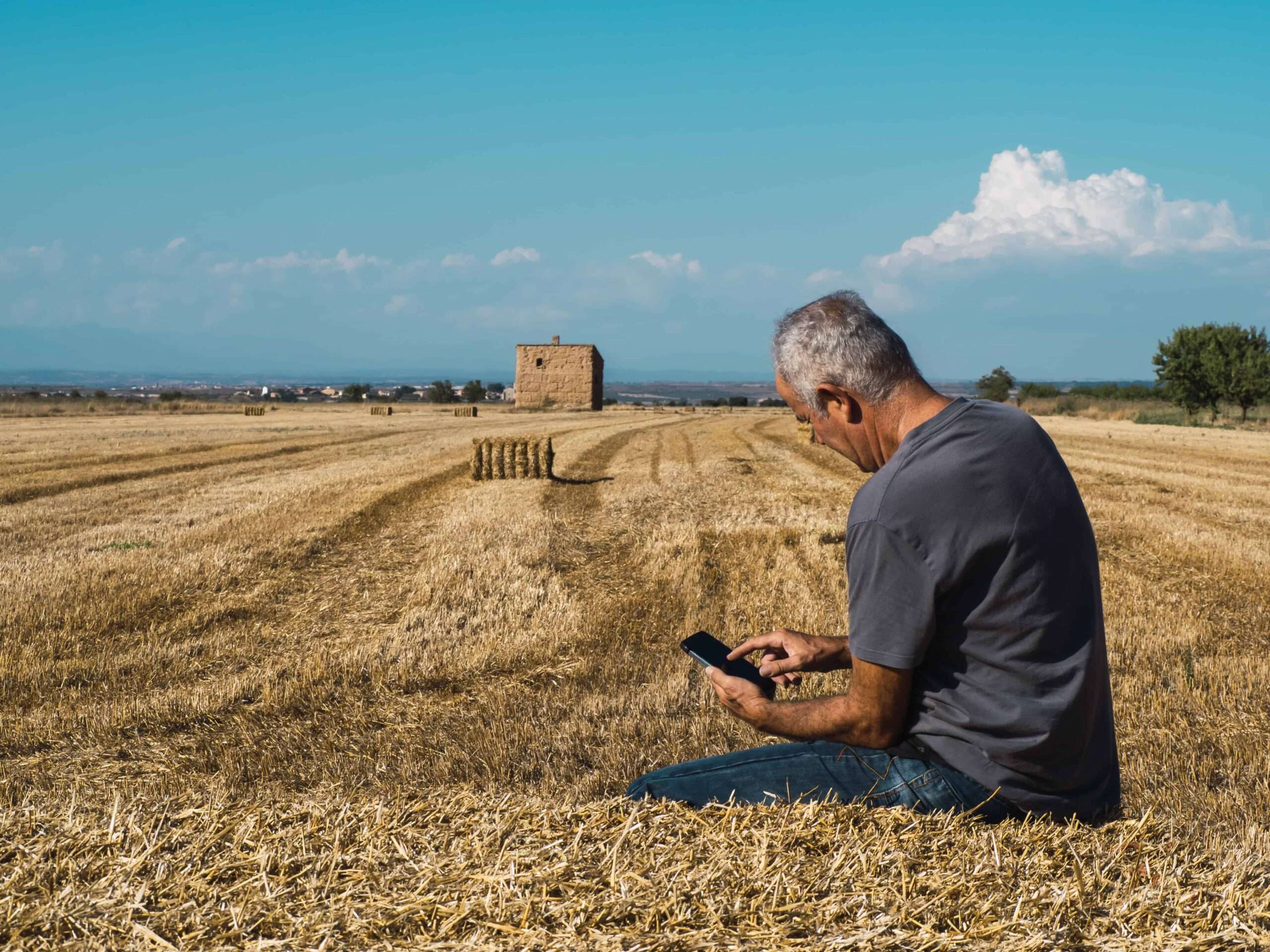
Strengthen social, human and intellectual capital in the places  – villages, cities, regions – that are facing pervasive challenges of shrinking population, distance to decision-making centers, and economic competitiveness handicaps, currently and in the next decades.

Within the next decades the digital, climate and socio-ecological transitions will reshape the world, globally and locally, and Low-Density Regions are in critical need of strengthening the interfaces between science, society and policy to avoid becoming the losers of rolling transitions.

Our goals
Foster innovative and creative ecosystems anchored in intensive knowledge that make it possible to co-create place-based geography of opportunities in low-density territorial contexts.

Facilitate collaborative learning and co-innovation processes built on multi-actor platforms focused on the co-creation of locally contextualized knowledge underpinned by data and scientific evidence on global trends.

Support the conception and the implementation of place-based development policies able to incorporate and stimulate the collective intelligence of the territories and promote local wellbeing.

Our approach

A five-step roadmap led by a  highly skilled multidisciplinary team

1

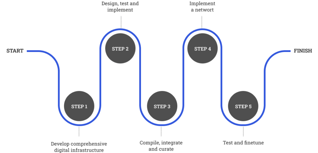
To develop comprehensive digital infrastructure, with a user interface, focusing on fostering user communities and enabling easy-to-understand data visualisation. It will empower data integration and analysis as well as methodological support for the developed models, tools and data

2

To select pilot territories, compiling data and information available, establishing multi-actor platforms and starting place-grounded exploratory immersive incursions to understand the key issues, local actors expectations, main conflicts, local-global interactions and SDGs trade-offs.

3

To design, test and implement integrative models, tools, indicators and variables for place-based standardised data collection and analysis, like territorial satellite accounts, well-being barometers, and Sustainable Development Goals – SDGs monitors.

4

To compile, integrate and curate core datasets maintained by the network, ensuring its reliability and compatibility for integration, also of the new datasets that will be developed and progressively integrated and shared.

5

To implement a network of smart living labs (SLL) in the LDR’s pilot territories covering different territorial levels. First, in regions where the Data4LowDensity network has already established a network with local actors building on years of formal and informal collaboration. Then it will expand the SSL network nationally and internationally, focusing on transnational territories across Europe building on the network and cooperation with national, European and international institutions engaged in data collection and monitoring e.g., ESPON, EUROSTAT, EUROBAROMETER, OECD.

6

SLL will test and finetune the digital interface aiming at improving its ability to effectively support the co-creation and co-innovation processes developed in the collaborative real-life environments; and it will convey the experimental facilities supporting the development, testing and implementation of innovative measurement models, monitoring tools and collaborative platforms, which are amongst the main Data4LowDensity activities.

CETRAD’s target pilot territories

Piloting DATA4LOWDENSITY at CETRAD

CETRAD has established partnerships to implement a Smart Living Lab in the Barroso (Alto Tâmega region), focusing on the local-global, personal and community well-being trade-offs induced by the energy transition.

Data4LowDensity at the CETRAD supported by its programmatic funding (UIDP/04011/2020) granted by national funds, through the FCT (Portuguese Foundation for Science and Technology)

CETRAD has ongoing SSL activities in Vila Marim parish (encompassing a group of 7 villages) in the Vila Real municipality, focusing on the development of small-scale social innovation solutions to enhance the well-being of aging and shrinking rural communities, and how that could be up-scaled.

Built on the ERAMUS+ project on learning villages LEARNVIL 2020-1-ES01-KA227-ADU-096064

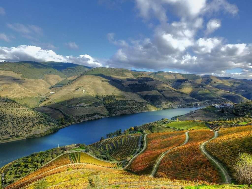
CETRAD has established partnerships and ongoing SSL activities in the wine region of Alto Douro Vinhateiro (Douro region) focusing on the competitiveness and sustainability of this singular Mediterranean mountainous vine & wine regional economy and the challenges placed by its agroecological transition.

Anchored on various projects including Innovine & Wine, Interact, Dourotour, Vinci Sudoe, AgriLin

CETRAD researchers are part of a multidisciplinary team that in partnership with the Côa Parque Foundation is developing the Special Program for Spatial Planning of the Côa Archaeological Park, contributing to the establishment of a regime to safeguard the archaeological heritage of the Côa Valley and to the co-conception of a sustainable development model of this low-density peripheral territory projecting globally its unique archaeological, natural, cultural and landscape heritage

Our services

Planning, implementation and information analysis and display built on participatory and collaborative methodologies applying transdisciplinary approaches (e.g., Living labs, Deliberative focus groups, Cognitive mapping, Stakeholder panels) and tools, such as surveys (through interviews or questionnaires), content analysis, social network analysis, among others.

Contextualized knowledge transfer and skill development through training customized for specific groups, to facilitate effective co-creation mechanisms, knowledge transfer, and advisory activities that support innovation, labor shortage and climate change and/or sustainability adaption and mitigation pathways in the farm, forestry, agri-food, tourism, or responsiveness in social services (e.g. eldercare, civil protection).

Provides support for entrepreneurs who want to develop innovative projects in LDR. This service supports new businesses, but also builds up intra-entrepreneurs. For example, counseling, mentoring, entrepreneurial training focused on emerging leadership for place-based innovation ecosystems.

Integrated accounts of socio-economic and non-market flows at regional and sub-regional levels. Money metrics will be used to enable integration of flows, measured with different metrics e.g., population, ecosystem services, voluntary work.

Sets of indicators and synthesis indexes measuring LDR territories on requested dimensions, like individual and collective well-being, competitiveness, connectivity, sustainability, resilience and inclusiveness and/or to monitor policies and goals at the local level (e.g., SDGs targets, Green Deal goals).

Cost-benefit analysis of energy, climate, agro-ecological, digital and labor transitions encompassing long-term, subjective beliefs and feelings as well as uncertainties, it can be done at the territory, value chains (e.g., agri-food) and sector (e.g., tourism, agriculture, social services) levels.

Provides bottom-line statistics and economic analysis on market trends. It intends to monitor prices, consumers and market dynamics at different levels of the supply chain focusing on the main activities in LDR. For example, the industries associated with agriculture, wine sector, forestry and tourism.

Integrating different types of data through a digital platform that will create, manage, analyze, and map the territories’ geography of opportunities based on the needs of diverse local and international actors, supporting their social, economic, and environmental development.

Systematization of European and national policy frameworks for the LDRs, assessment of their relevance based on the territories’ profile. Also, preparing guidelines for local agents (public, private, associative), developing projects and applying for funds.

Using a transdisciplinary approach, R&D teams will design and visualize data-driven, real-life forecasts and develop a variety of future scenarios (e.g., best-case or worst-case scenario) in the pilot territories

Others – By demand (e.g. Network analysis of tourism sector stakeholders)